Images Courtesy of USGS
These images, which were captured using advanced sensors on satellites Landsat 5 and 7, ASTER, and MODIS currently orbiting Earth are proof that the line between science and art is hazy at best.
Note: Click Images to Enlarge
—
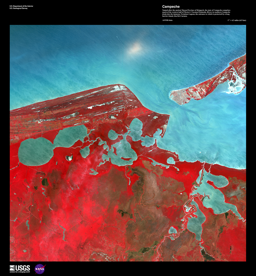
Campeche
Named after the ancient Mayan Province of Kimpech, the state of Campeche comprises much of the western half of Mexico’s Yucatan Peninsula. Rivers in southern Campeche drain into the immense Terminos Lagoon, the entrance to which is protected by a long barrier island, Isla Del Carmen.
—
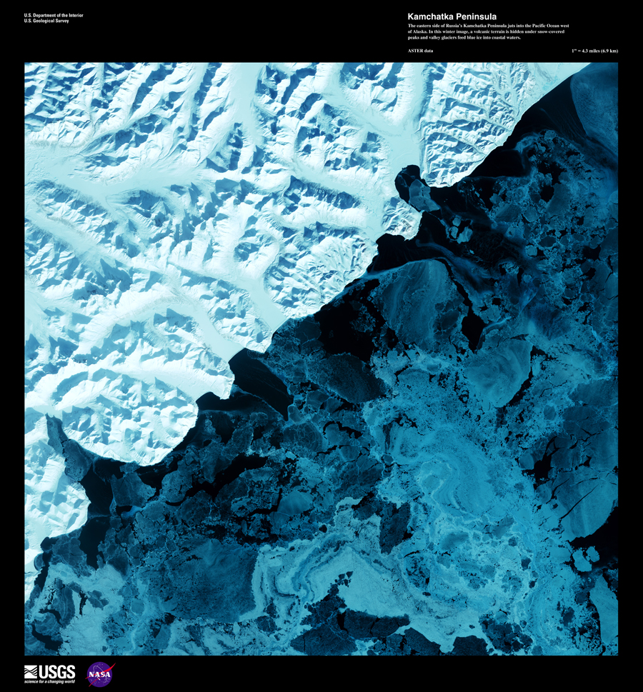
Kamchatka Peninsula
The eastern side of Russia’s Kamchatka Peninsula juts into the Pacific Ocean west of Alaska. In this winter image, a volcanic terrain is hidden under snow-covered peaks and valley glaciers feed blue ice into coastal waters.
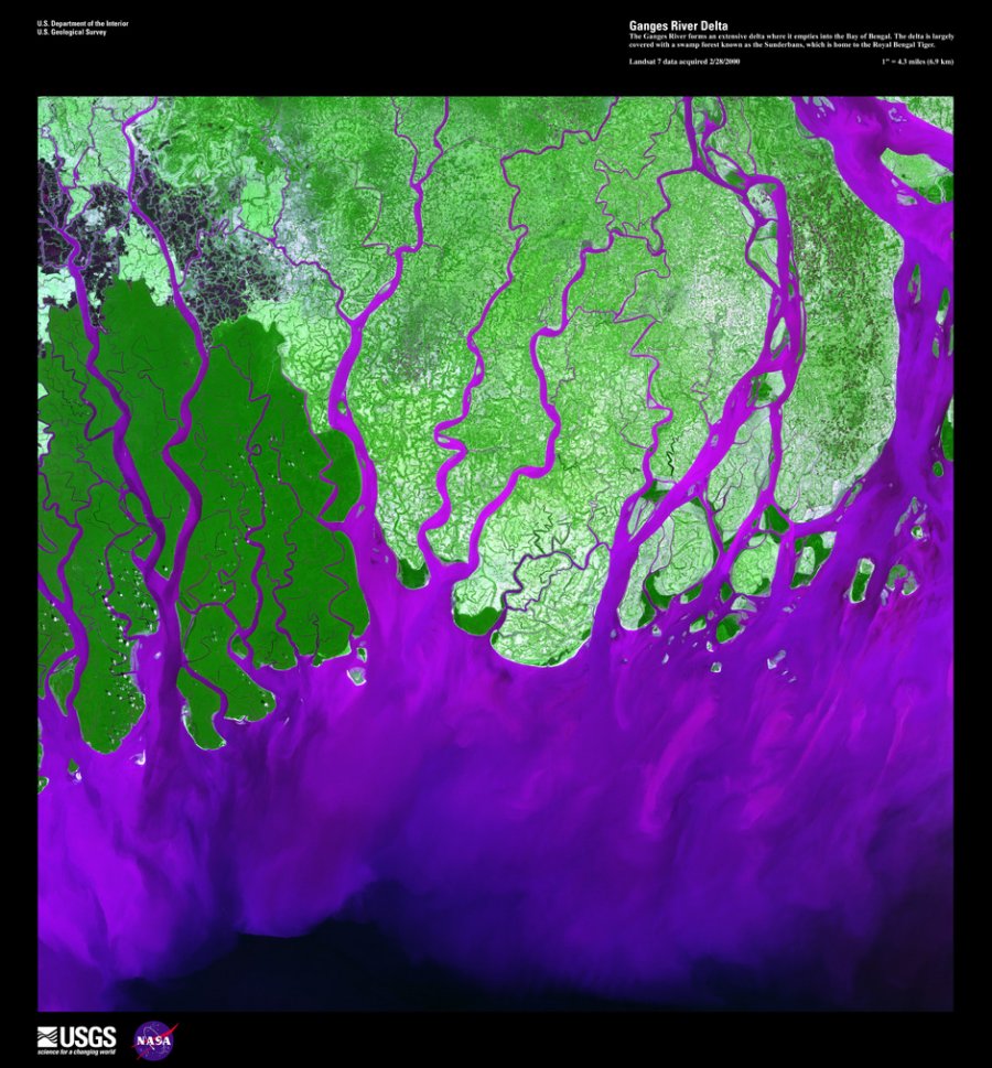
Ganges River Delta
The Ganges River forms an extensive delta where it empties into the Bay of Bengal. The delta is largely covered with a swamp forest known as the Sunderbans, which is home to the Royal Bengal Tiger.
—
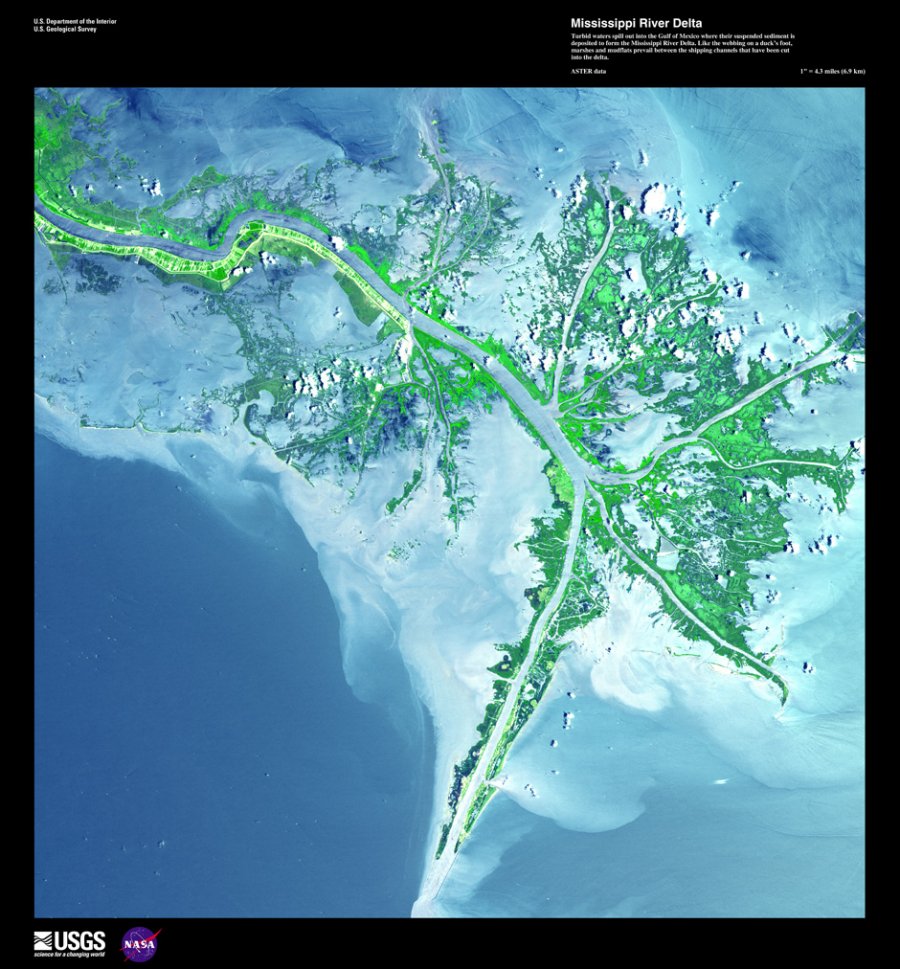
Mississipi River Delta
Turbid waters spill out into the Gulf of Mexico where their suspended sediment is deposited to form the Mississippi River Delta. Like the webbing on a duck’s foot, marshes and mudflats prevail between the shipping channels that have been cut into the delta.
—
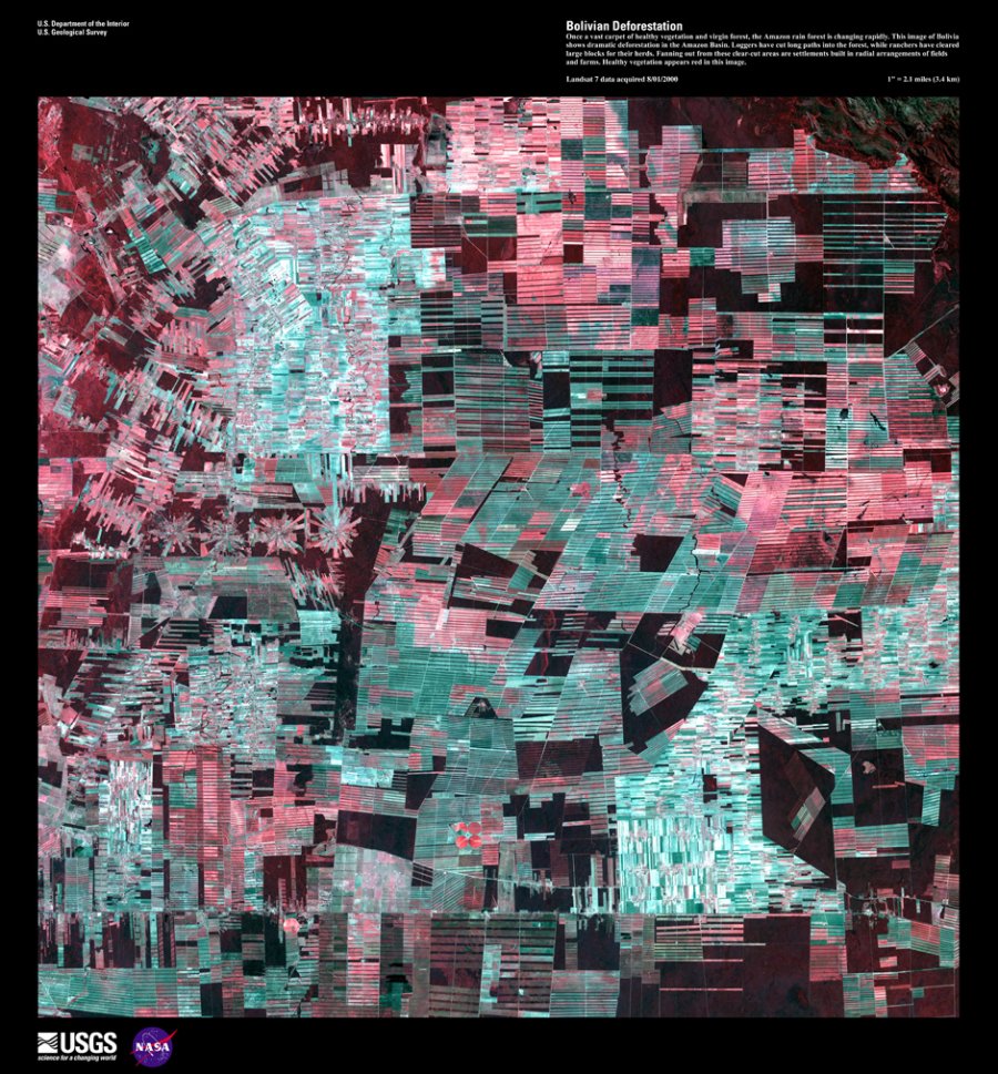
Deforestation in Bolivia
Once a vast carpet of healthy vegetation, the Amazon rain forest is changing rapidly. This image of Bolivia shows dramatic deforestation in the Amazon Basin. Loggers have cut long paths into the forest, while ranchers have cleared large blocks for their herds. Fanning out from these clear-cut areas are settlements built in radial arrangements of fields and farms. Healthy vegetation appears bright red in this image.
—
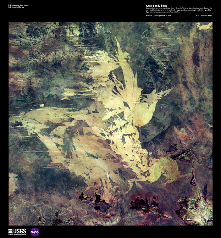
Great Sandy Scars
In a small corner of the vast Great Sandy Desert in Western Australia, large sand dunes—the only sand in this desert of scrub and rock—appear as lines stretching from left to right. The light-colored fan shapes are scars from wildfires.
—
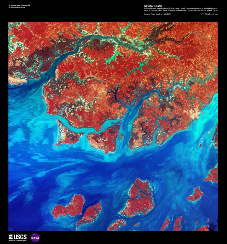
Guinea-Bissau
Guinea-Bissau is a small country in West Africa. Complex patterns can be seen in the shallow waters along its coastline, where silt carried by the Geba and other rivers washes out into the Atlantic Ocean.
—
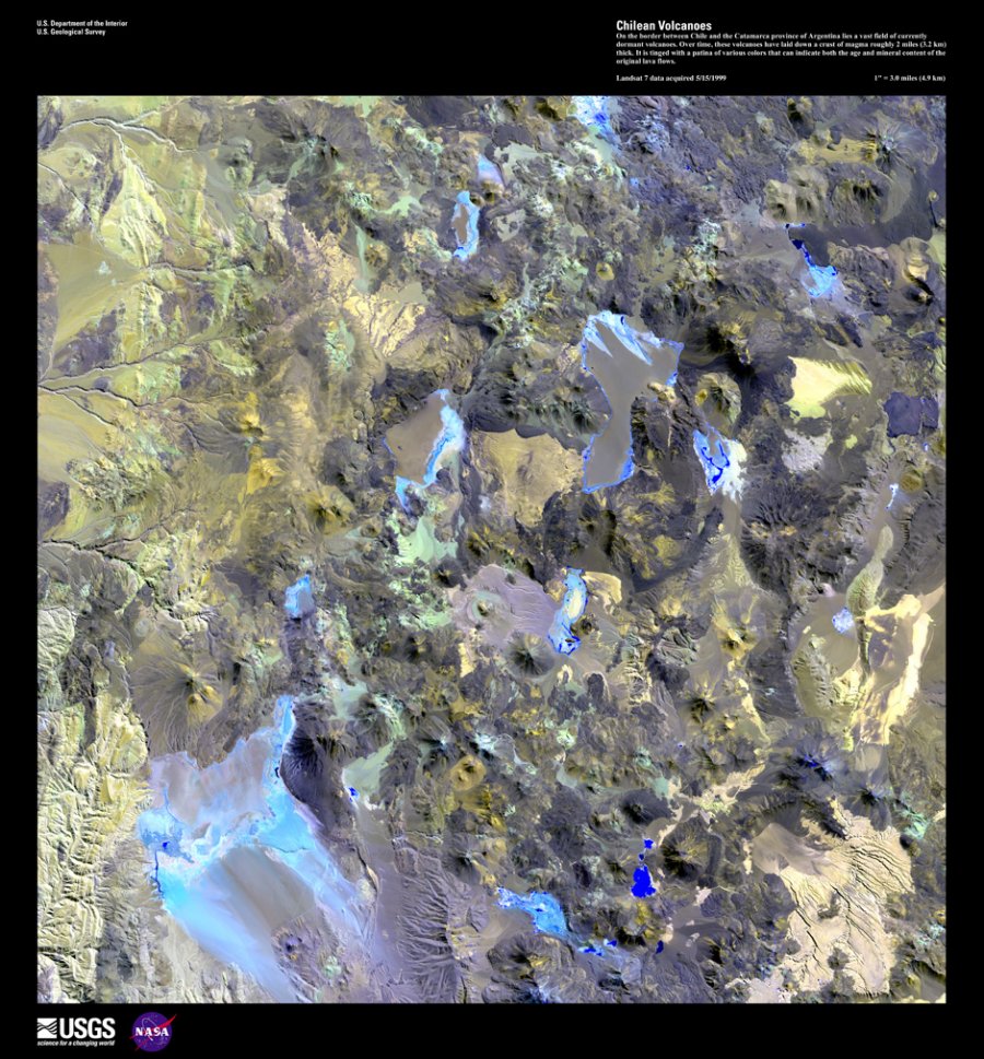
Chilean Volcanoes
On the border between Chile and the Catamarca province of Argentina lies a vast field of currently dormant volcanoes. Over time, these volcanoes have laid down a crust of magma roughly 2 miles (3.2 km) thick. It is tinged with a patina of various colors that can indicate both the age and mineral content of the original lava flows.
—
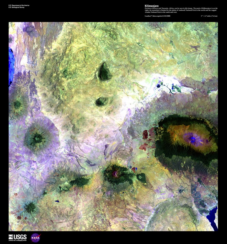
Kilimanjaro
Portions of Kenya and Tanzania, Africa can be seen in this image. The peak of Kilimanjaro is on the right; the mountain is flanked by the plains of Amboseli National Park to the north and the rugged Arusha National Park to the south and west.
—
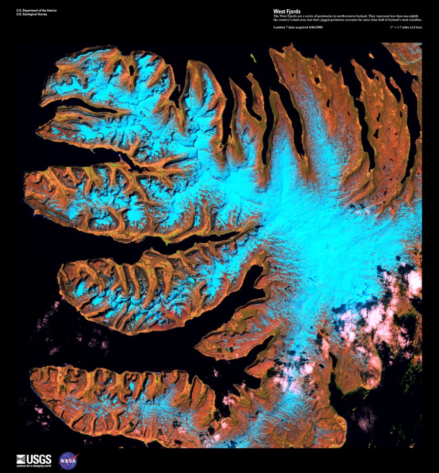
West Fjords
The West Fjords are a series of peninsulas in northwestern Iceland. They represent less than one-eighth the country’s land area, but their jagged perimeter accounts for more than half of Iceland’s total coastline.
[smartads]
—
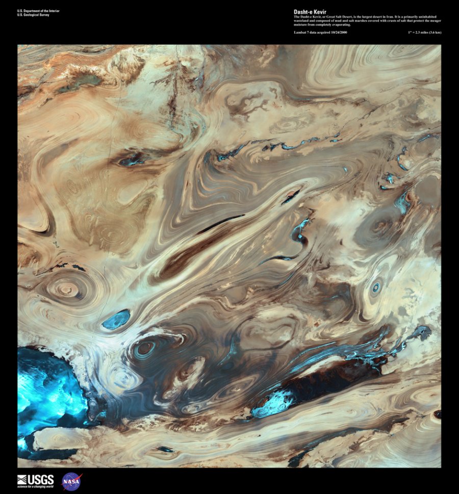
Dasht-e Kevir
The Dasht-e Kevir, or Great Salt Desert, is the largest desert in Iran. It is a primarily uninhabited wasteland, composed of mud and salt marshes covered with crusts of salt that protect the meager moisture from completely evaporating.
—
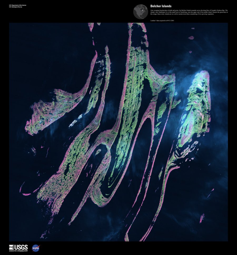
Belcher Islands
Like sweeping brushstrokes of pink and green, the Belcher Islands meander across the deep blue of Canada’s Hudson Bay. The islands’ only inhabitants live in the small town of Sanikiluaq, near the upper end of the middle island. Despite the green hues in this image, these rocky islands are too cold to sustain more than a smattering of low-growing vegetation
—




Anonymous
February 9, 2013
Deforestation in Bolivia looks messed up.
esp
March 12, 2013
Amazing it’s hard to beleive this isn’t the result of someone being let loose with photoshop. Still worth looking at 🙂